Vibe Coding and the Fragmentation of Open Source
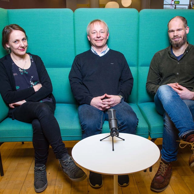
Why Machine-Writing Code is the Best (and Most Dangerous) Thing for Geospatial: The current discourse surrounding AI coding is nothing if not polarized. On one side, the technofuturists urge us to throw away our keyboards; on the other, skeptics dismiss Large Language Models (LLMs) as little more than "fancy autocomplete" that will never replace a "real" engineer. Both sides miss the nuanced reality of the shift we are living through right now. I recently sat down with Matt Hansen, Director of Geospatial Ecosystems at Element 84, to discuss this transition. With a 30-year career spanning the death of photographic film to the birth of Cloud-Native Geospatial, Hansen has a unique vantage point on how technology shifts redefine our roles. He isn’t predicting a distant future; he is describing a present where the barrier between an idea and a functioning tool has effectively collapsed. The "D" Student Who Built the Future Hansen’s journey into the heart of open-source leadership began with what he initially thought was a terminal failure. As a freshman at the Rochester Institute of Technology, he found himself in a C programming class populated almost entirely by seasoned professionals from Kodak. Intimidated and overwhelmed by the "syntax wall," he withdrew from the class the first time and scraped by with a "D" on his second attempt. For years, he believed software simply wasn't his path. Today, however, he is a primary architect of the SpatioTemporal Asset Catalog (STAC) ecosystem and a major open-source contributor. This trajectory is the perfect case study for the democratizing power of AI: it allows the subject matter expert—the person who understands "photographic technology" or "imaging science"—to bypass the mechanical hurdles of brackets and semi-colons. "I took your class twice and thought I was never software... and now here I am like a regular contributor to open source software for geospatial." — Matt Hansen to his former professor. The Rise of "Vibe Coding" and the Fragmentation Trap We are entering the era of "vibe coding," where developers prompt AI based on a general description or "vibe" of what they need. While this is exhilarating for the individual, it creates a systemic risk of "bespoke implementations." When a user asks an AI for a solution without a deep architectural understanding, the machine often generates a narrow, unvetted fragment of code rather than utilizing a secure, scalable library. The danger here is a catastrophic loss of signal. If thousands of users release these AI-generated fragments onto platforms like GitHub, we risk drowning out the vetted, high-quality solutions that the community has spent decades building. We are creating a "sea of noise" that could make it harder for both humans and future AI models to identify the standard, proper way to solve a problem. Why Geospatial is Still "Special" (The Anti-meridian Test) For a long time, the industry mantra has been "geospatial isn’t special," pushing for spatial data to be treated as just another data type, like in GeoParquet. However, Hansen argues that AI actually proves that domain expertise is more critical than ever. Without specific guidance, AI often fails to account for the unique edge cases of a spherical world. Consider the "anti-meridian" problem: polygons crossing the 180th meridian. When asked to handle spatial data, an AI will often "brute force" a custom logic that works for a small, localized dataset but fails the moment it encounters the wrap-around logic of a global scale. A domain expert knows to direct the AI toward Pete Kadomsky’s "anti-meridian" library. AI is not a subject matter expert; it is a powerful engine that requires an expert navigator to avoid the "Valley of Despair." Documentation is Now SEO for the Machines We are seeing a counterintuitive shift in how we value documentation. Traditionally, README files and tutorials were written by humans, for humans. In the age of AI, documentation has become the primary way we "market" our code to the machines. If your open-source project lacks a clean README or a rigorous specification, it is effectively invisible to the AI-driven future of development. By investing in high-quality documentation, developers are engaging in a form of technical SEO. You are ensuring that when an AI looks for the "signal" in the noise, it chooses your vetted library because it is the most readable and reliable option available. From Software Developers to Software Designers The role of the geospatial professional is shifting from writing syntax to what Hansen calls the "Foundry" model. Using tools like GitHub Specit, the human acts as a designer, defining rigorous blueprints, constraints, and requirements in human language. The machine then executes the "how," while the human remains the sole arbiter of the "what" and "why." Hansen’s advice for the next generation—particularly those entering a job market currently hostile to junior engineers—is to abandon generalism. Don't just learn to code; become a specialist in a domain like geospatial. The ability to write Python is becoming a commodity, but the ability to design a system that accounts for the nuances of remote sensing is an increasingly rare and valuable asset. History Repeats: The "Priesthood" of Assembly This shift mirrors the 1950s, when the "priesthood" of assembly programmers looked at the first compilers with deep suspicion. Kathleen Booth, who wrote the first assembly language, lived in a world where manual coding was an arcane, elite skill. Those early programmers argued that compilers were untrustworthy and that a human could always write "better" code by hand. They were technically right about efficiency, but they were wrong about the future. Just as the compiler was "good enough" to allow us to move "up the stack" and take on more complex problems, AI is the next level of abstraction. We might use a "Ralph Wiggum script"—a loop that feeds AI output back into itself until the task is "done"—and while it may be a brute-force method, it is often more productive than the perfection of the past. Conclusion: The Future is a Specialist's Game We are moving away from being the writers of code and toward being the designers of systems. While the "syntax wall" has been demolished, the requirement for domain knowledge has only grown higher. The keyboard isn't dying; it is being repurposed for higher-level architectural thought. As the industry experiences a "recursive improvement" of these tools, the question for every professional is no longer about whether the machine can do your job. It’s whether you have the specialized expertise to tell the machine what a "good enough" job actually looks like. Are you prepared to stop being a coder and start being a designer?

Denne episoden er hentet fra en åpen RSS-feed og er ikke publisert av Podme. Den kan derfor inneholde annonser.

Episoder(270)

Cloud-Native Geospatial for Small Teams

Cloud-Native Geospatial for Small Teams

Cloud-Native Geospatial for Small Teams: How the Utah Geological Survey Did It What happens when a small, technical team at a state agency decides to go cloud native? They don't have terabytes of sate...

23 Sep 37min

GERS, Metadata, and Maps Built for Machines

GERS, Metadata, and Maps Built for Machines

We already have a map. Actually, we have lots of maps. So why did Overture build another one? My guest in this episode is Amy Rose, CTO of the Overture Maps Foundation, and she makes a pretty compelli...

17 Sep 48min

The Evolution of Positioning Systems

The Evolution of Positioning Systems

Republished Episode - I wanted to resurface this episode because positioning is everything, and it's a great overview of how it works.   Right now you are being bathed in radio signals from about 35 s...

9 Sep 54min

Sentinel Bird

Sentinel Bird

Earlier this year I ran a small experiment called the Geospatial Launchpad — six weeks of working closely with a couple of people to help them push their geospatial projects forward. West was one of t...

7 Sep 28min

Fields Of The World

Fields Of The World

Where does one field end and the next one begin? It sounds trivial right up until you try to answer it. In this episode, I'm joined by Hannah Kerner — Assistant Professor at Arizona State University, ...

18 Aug 43min

Virtual Worlds for Physical AI Systems

Virtual Worlds for Physical AI Systems

In this episode I'm joined by Apurva Shah, co-founder and CEO of Duality AI, a company building virtual worlds — or "world models" for robots and physical AI systems. Apurva's path here is an unusual ...

4 Aug 49min

GPS, But 100 Times Stronger

GPS, But 100 Times Stronger

My guest today is Tyler Reid, co-founder and CTO of Xona, a company building the first commercial satellite navigation system. We get into why Tyler and his team are moving satellites into low Earth o...

29 Jul 43min

Turning Aerial Imagery Into a Searchable World

Turning Aerial Imagery Into a Searchable World

Vexcel isn't a household name — but you've almost certainly used their data. This aerial imaging company flies low-elevation aircraft across roughly 45 countries, capturing imagery at 7.5cm resolution...

28 Jul 55min

Populært innen Vitenskap

fastlegen
romkapsel
tingenes-tilstand
jss
liberal-halvtime
forskningno
sinnsyn
rekommandert
villmarksliv
rss-paradigmepodden
fjellsportpodden
tomprat-med-gunnar-tjomlid
grunnstoffene
nordnorsk-historie
rss-nysgjerrige-norge
tidlose-historier
psykopoden
rss-rekommandert
rss-inn-til-kjernen-med-sunniva-rose
smart-forklart